Wagtail-Geo-Widget is the complete map solution for your Wagtail site.


Project description


Wagtail-Geo-Widget
Wagtail-Geo-Widget is the complete map solution for your Wagtail site.
Features
- Supports Google Maps or any tile provider supported by Leaflet (such as Open Street Map or Mapbox)
- Real spatial support (with GeoDjango and PointField)
- Storing coordinates as strings (for no-GeoDjango setups)
- StreamField integration
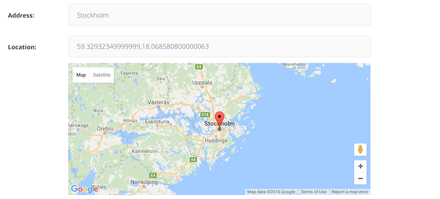
- Searching with geocoding (supports Google Geocoding, Nominatim and Mapbox)
- Inline panel support
- Optional address search field
- Language support
Documentation
- Getting started with Google Maps
- Getting started with Leaflet
- Settings
- Adding the widget to a Page
- Integrating with GeoDjango
- Adding to a StreamField
- Supported Geocoders
- FAQ
Contribute
If you have ideas for improvement, please share your thoughts through an issue.
- Issue Tracker: https://github.com/Frojd/wagtail-geo-widget/issues
- Source Code: https://github.com/Frojd/wagtail-geo-widget
- Contribution documentation
We also welcome Pull Requests (PR). Please note that this project uses git-flow so please use the develop branch when creating PR's.
Security
If you believe you have found a security issue with any of our projects please email us at security@frojd.se.
License
Wagtail-Geo-Widget is released under the MIT License.
Release history Release notifications | RSS feed


Download files
Download the file for your platform. If you're not sure which to choose, learn more about installing packages.
Source Distribution
Built Distribution
Filter files by name, interpreter, ABI, and platform.
If you're not sure about the file name format, learn more about wheel file names.
Copy a direct link to the current filters
File details
Details for the file wagtailgeowidget-9.1.0.tar.gz.
File metadata
- Download URL: wagtailgeowidget-9.1.0.tar.gz
- Upload date:
- Size: 21.1 kB
- Tags: Source
- Uploaded using Trusted Publishing? No
- Uploaded via: twine/6.2.0 CPython/3.9.24
File hashes
| Algorithm | Hash digest | |
|---|---|---|
| SHA256 |
40051187d4920be84442a999ce3f9dc6494a9fffc3dfe042aad11bc5df2356f8
|
|
| MD5 |
482234ea2623a1d52b8aeebd5fb4447e
|
|
| BLAKE2b-256 |
0e719bd1d48fe61e537f47ca76f8bf96ebd95eb2b0df8b79c1170b636da8210e
|
File details
Details for the file wagtailgeowidget-9.1.0-py3-none-any.whl.
File metadata
- Download URL: wagtailgeowidget-9.1.0-py3-none-any.whl
- Upload date:
- Size: 25.4 kB
- Tags: Python 3
- Uploaded using Trusted Publishing? No
- Uploaded via: twine/6.2.0 CPython/3.9.24
File hashes
| Algorithm | Hash digest | |
|---|---|---|
| SHA256 |
6f098c052715362bd6a2526687674fe258a6ceca4fc00f27b050ffcc6f0bd3ef
|
|
| MD5 |
88e31574adbbaf4c524e1826f08b1ead
|
|
| BLAKE2b-256 |
200b2b669f011870ab710a647503dc6558e8d635c12083ed793f4bb3284906aa
|


